
To receive daily emails from Breaking Christian News to your inbox CLICK HERE


SHARE THIS ARTICLE Printer friendly version of this page

Prayer Alert: 2 Hurricanes in the Pacific On a Collision Course, While a Giant Nor'easter Is Flooding the East Coast

Michael Snyder : Sep 25, 2026  Charisma Media

The weather has become very "interesting" during the second half of 2026, and I am convinced that a lot more surprises are still ahead.

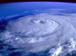
[Charisma News] What happens when two massive hurricanes collide? It looks like we are about to find out. Hurricane Polo and Hurricane Odalys are heading directly toward one another. Meteorologists have some theories about what will happen as they slam into one another, but nobody really knows. Meanwhile, Tropical Storm Nolo is poised to become Hurricane Nolo. We are being told that it could drop several feet of rain on some parts of Hawaii. Of course the east coast is not being left out of the chaos either. An absolutely huge nor'easter is already causing severe flooding on the east coast. We were anticipating that we would see some absolutely crazy weather this fall, and that is exactly what we are getting. (Image: Pexels)

Hurricane Polo has been absolutely shocking the experts for days.

It went from being a weak tropical storm to a Category 5 hurricane in just 24 hours.

On Thursday, it dropped down to a Category 4 storm, but we were being told that some "near-term strengthening is possible"...

Hurricane Polo's intensity oscillated between Category 4 and Category 5 on Thursday as its path started moving away from Mexico's southwestern coast. The storm was expected to remain offshore, while its outer rainbands spread across southwestern Mexico, the U.S. National Hurricane Center said.

"Some near-term strengthening is possible, and Polo is expected to remain a powerful major hurricane for the next few days," the Miami-based center said.

That forecast turned out to be accurate, because now it appears that Hurricane Polo is about to strengthen into a Category 5 storm for a third time...

There is nothing about Hurricane Polo that is normal.

The rate at which it originally intensified into a very powerful hurricane stunned everyone, and it ultimately became the second most powerful storm ever recorded in the Eastern Pacific...

Its intensification was dramatic even by those standards, with winds that skyrocketed from 45 mph early Monday morning to 150 mph at around the same time the following day. The hurricane center described its transformation as "truly remarkable."

Its maximum sustained winds climbed as high as 180 mph at one point, far exceeding the 157 mph threshold for Category 5, the strongest on the hurricane scale.

Polo's central pressure—an indicator of its strength and potential destructiveness—made it the second-strongest hurricane on record in the Eastern Pacific, behind 2015's Hurricane Patricia. The storm's wind speeds tied 2009's Hurricane Rick as the third-strongest on record for the region.

In addition, a temperature reading that was actually taken inside the eye of Hurricane Polo matched an all-time record that was established by Hurricane Rita all the way back in 2005...

The flight-level temperature reading inside Polo's eye on Tuesday "tied Hurricane Rita's in 2005 for the warmest on record, surpassing even some of the most intense western Pacific Super Typhoons ever directly observed like Megi in 2010," Lowry wrote, crediting Derrick Herndon, a hurricane researcher at the University of Wisconsin-Madison's Cooperative Institute for Meteorological Satellite Studies.

"Simply put, the amount of latent heat being released inside the core of Polo from the intense ring of thunderstorms surrounding its eye (the notorious eyewall) was exceptional, a rare show of force from Mother Nature when everything aligns to form one of the most powerful storms on Earth," Lowry wrote.

Everything about this storm seems designed to get our attention.

And now Hurricane Polo is on a collision course with another hurricane.

Hurricane Polo is currently headed in a northwesterly direction and that will take it right into the path of Hurricane Odalys...

Cat. 5 Hurricane Polo is moving northwest off the coast of Mexico towards Baja California where it's expected to interact with Cat. 1 Hurricane Odalys. Interactions between cyclones where they begin to rotate around a common center point begin around 1400 km (870 miles) apart.

Many meteorologists think that Odalys will fizzle out as it encounters Polo.

But Philippe Papin, a senior hurricane specialist at the National Hurricane Center, is warning that there is a possibility that Hurricane Odalys could actually "pull Polo further to the north"...

To the west of Polo, Hurricane Odalys was spinning over the Pacific Ocean. While this storm was not expected to approach land, it could interact with Polo.

"It might pull Polo further to the north, while Odalys could be pulled to the south," Papin said. "It depends on how close they get together and the overall intensity of those circulations."

That is a major bombshell.

Right now, we are being assured that Hurricane Polo will make landfall somewhere along the Baja peninsula...

But if Hurricane Polo gets pulled "further to the north", it could bypass the Baja peninsula altogether.

In such a scenario, there is a possibility that it could actually make landfall in California.

Needless to say, that would be a truly monumental event.

At the same time, Tropical Storm Nolo is getting stronger as it heads toward Hawaii...

Hawaii's Big Island is under a hurricane watch as Tropical Storm Nolo strengthens in the Pacific Ocean, threatening to dump up to 3 feet of rain on the island this week, the National Hurricane Center said.

Nolo formed Wednesday and could become a hurricane by Thursday night, around the time heavy rainfall on the Big Island could also begin, forecasters said. They also warned that the storm could become a major hurricane by the weekend, meaning a Category 3 or higher.

This is also a very serious storm.

At this stage, even Accuweather is warning that Nolo could potentially do even more damage than Hurricane Lala did...

Hawaii is facing its biggest tropical threat so far this hurricane season with newly named Tropical Storm Nolo forecast to become a Category 3 storm as it nears the Big Island into the weekend.

The impacts could be even more severe than Hurricane Lala, which left residents of the Big Island in "total shock" due to the magnitude of the damage. Communication was cut off for some areas, with the hardest-hit areas of Hawaii being without power for over a week.

Friday and Saturday are expected to be the critical days for this storm.

Maui is expected to get about 20 inches of rain and the Big Island is expected to get up to 35 inches of rain in some areas.

But if a worst case scenario materializes, Accuweather says that up to 55 inches of rain is possible...

Rainfall totals could reach as high as 35 inches at higher elevations on the Big Island and 20 inches on Maui, much of it at excessive rainfall rates that will make flooding likely, according to hurricane center forecasts.

"This rainfall may produce catastrophic life-threatening flooding and mudslides, especially in areas of steep terrain," the hurricane center said in a forecast late Wednesday night Hawaii time.

A forecast from AccuWeather says that as much as 55 inches of rain is possible from Nolo, which could rival Hawaii's all-time highest rainfall total from a tropical cyclone. The record now belongs to Hurricane Lane, which dumped 58 inches on the Big Island in 2018.

I can't even imagine what that much rain would look like.

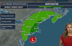
On the east coast, a very scary nor'easter is going to create all sorts of chaos in the days ahead.

It is technically not a hurricane, but in many ways it is acting like one.

In fact, we are being told that models are projecting that it will develop "a giant eye at its center by Saturday"...

Millions of Americans have been warned to prepare now as a massive storm approaches the East Coast.

Meteorologists are monitoring a nor'easter, a strong storm off the US coast in the Atlantic, expected to slam into the Northeast in just hours, bringing heavy downpours, coastal flooding, tropical storm-force winds and power outages from Virginia to Maine.

Weather models tracking the nor'easter show it developing a giant eye at its center by Saturday, a formation similar to those seen in hurricanes.

This storm is going to cause so much flooding.

In fact, severe coastal flooding has already started in Virginia...

Flooding began on Wednesday morning in Norfolk, Virginia, where 1 to 2 feet of seawater inundated coastal areas. Rain compounded the tidal flooding, according to AccuWeather Reporter Leslie Hudson, who was covering the storm's impacts in southeastern Virginia.

"You can't get through with low-profile vehicles," Hudson said on Wednesday evening along a flooded road in Norfolk. To add to the dangers, it wasn't just water in the streets. "There's also some fire ant flotillas. There's also gasoline. There's also oil. Several of the cars that have flooded out, of course, are leaking fluids. So altogether it's just not a great recipe."

We haven't seen a storm of this magnitude on the east coast in quite a while.

Meteorologists are expecting that New England will get hit the hardest...

The heaviest impacts are predicted throughout New England, hitting Connecticut, Rhode Island, Massachusetts, New Hampshire and southern Maine with winds potentially reaching 70 mph and four to eight inches of rain in many areas.

AccuWeather Chief Meteorologist Jon Porter warned in a statement: 'This storm may be remembered for its destructive coastal flooding and severe beach erosion, especially along eastern Long Island and the Massachusetts coast.'

Coastal flood warnings have been issued in New York, New Jersey, Delaware, Maryland and Virginia on Thursday, with the National Weather Service (NWS) saying that over three feet of water from the sea will be pushed onto land in these areas.

If you live on the east coast, please take this storm very seriously.

If you live in Hawaii, please stay inside this weekend.

And if you live in California, I would suggest watching the path of Hurricane Polo very closely.

The weather has become very "interesting" during the second half of 2026, and I am convinced that a lot more surprises are still ahead. Subscribe for free to Breaking Christian News here

Michael Snyder's new book entitled "10 Prophetic Events That Are Coming Next" is available in paperback and for the Kindle on Amazon.com



SHARE THIS ARTICLE Printer friendly version of this page

To receive daily emails from Breaking Christian News to your inbox CLICK HERE

Other Recent Articles from Breaking Christian News

Prayer Alert: 2 Hurricanes in the Pacific On a Collision Course, While a Giant Nor'easter Is Flooding the East Coast

New Poll Shows Spiritual Revival Among Gen Z

Hundreds Choose Christ as College Revival Reaches Pepperdine: 'What a Night!! What a God!!'

I Debated One of Charlie Kirk's Rivals. Her Response Was Shocking

Oregon Mom Is Free to Adopt After Winning Legal Battle Over Gender-Ideology Mandate

Benefits of Trump's 2025 Tax Cuts Touted by Manufacturers in All 50 States

Trump Butler Assassination Attempt Victim Dies After Suffering from Wounds Following Attack

Netanyahu's Powerful Speech at UN: Blasts 'Genocide' Charges, Says Days of 'Defenseless' Jews are Over

Supreme Court Hands President Trump a Big Win on Election Integrity

2,293 Female Athletes Have Lost First-Place Medals to Biological Males, Research Shows

Criminal Investigation Underway in Canada after Family Says Christian Grandmother Euthanized Without Consent

Israel Votes in Five Weeks. Its American Voters Could Decide Who Wins

Massive Coalition of Left-Wing Groups Lobbied to Block the SAVE America Act

DHS Debunks 7 'Lies Spread by Mainstream Media' About the Austin Shooting

Judge Orders Trump to 'Immediately' Restore Privileged White House Access to CNN, MS NOW and Politico

Xi and President Trump; What to Expect during the Chinese Leader's US Visit

Football Team Under Fire for Reciting 'Lord's Prayer'

'Praise the Lord': Florida Mother Learns Missing Teen Is Safe during News Conference (Video)

EPA to Include Abortion Drugs in Chemical Tests of Drinking Water

Five Shocking Changes Being Proposed to Pennsylvania Health Code by Governor Shapiro


Search the Articles Archives

Keyword:  
Author:  
Words Posted On:  
Day Month Year


Subscribe to
Breaking Christian News


Follow BCN on Twitter
Are You Praying for Our Government Leaders?
BCN Staff

Steve Shultz
Steve Shultz, Managing Editor
Founder and Owner


Aimee Herd
Aimee Herd, Editor


BCN Plus
Are You Praying for President Trump?


All articles on this site and emails from BCN are copyrighted property of Breaking Christian News. Permission is given to link to, or share a BCN story if proper attribution is given to both the original writer and summarizer of the story. Breaking Christian News 2005-2019. All Rights Reserved.


Breaking Christian News is a division of Elijah List Publications, Inc. All Rights Reserved


Disclaimer: Articles and links, as well as the source articles linked to; do not necessarily reflect the opinion of Breaking Christian News.

editor@breakingchristiannews.com